Join Us for a Public Meeting | Tuesday August 15, 2023
Public Meeting Presentation on August 15, 2023
Join the City of Bonita Springs for a Public Information Meeting, Tuesday, June 25 at 5 p.m.
The project team has developed two alternatives for Rosemary Drive. To learn more about the alternatives and to select your preferred alternative:
August 15, 2023 Public Meeting Presentation
About the Project
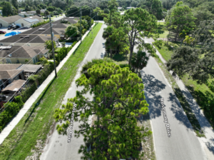
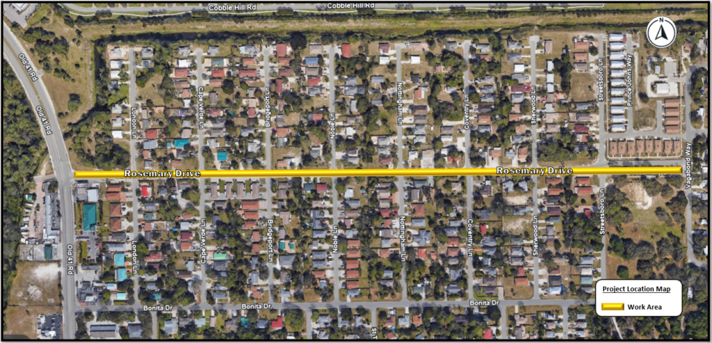
The City of Bonita Springs begins the Rosemary Drive Stormwater and Multi-Use Pathway Engineering Design Project that will include the redesign of Rosemary Drive from Old 41 Road to Vagabond Way. The design will provide improvements for motorists, school buses, pedestrians, and bicyclists. The redesign of Rosemary Drive will include a multi-use pathway, intersection improvements, pavement, and signage improvements, streetlighting, landscaping and irrigation. The design will also include a closed drainage system with curb and gutter. A closed storm drainage system is an underground network of pipes and chambers that collect and carry rainwater. These systems are beneficial for areas with high volumes of rainfall. The system efficiently transports water while keeping it out of sight, enhancing the aesthetic appeal of neighborhoods.
The project team has developed two alternatives for Rosemary Drive. The conceptual designs for both alternatives include a 10-foot-wide multi-use pathway on the south side of the road and a six-foot-wide sidewalk on the north side of the road. Also included is landscaping and street lighting similar to the existing downtown streetlights. The difference between Alternative 1 and 2 is the crosswalk design. Alternative 1 includes raised crosswalks at Cape Verde Lane, Bridgeport Lane, Noble Lane, Coventry Lane, and Streetsboro Lane. Alternative 2 includes crosswalks in the same locations with a pedestrian refuge area in the crosswalk. This allows the pedestrian to cross one side of the road and wait in the middle of the road on the island until traffic is clear to cross the other lane. Design is expected to be complete in spring 2025.
The City invites the public to attend a public information meeting to learn about the design and provide the opportunity for the public to express their views about the project. Project display boards will be available for the public to view, and city staff and the project team will be available for the public to speak with one-on-one. This is an open house format there will be no presentation.
Sobre el proyecto
La ciudad de Bonita Springs comienza el Proyecto de diseño de ingeniería de vías de usos múltiples y aguas pluviales de Rosemary Drive que incluirá el rediseño de Rosemary Drive desde Old 41 Road hasta Vagabond Way. El diseño proporcionará mejoras para los automovilistas, autobuses escolares, peatones y ciclistas. El rediseño de Rosemary Drive incluirá un camino de usos múltiples, mejoras en las intersecciones, mejoras en el pavimento y la señalización, alumbrado público, paisajismo e irrigación. El diseño también incluirá un sistema de drenaje cerrado con bordillo y canalón. Un sistema cerrado de drenaje pluvial es una red subterránea de tuberías y cámaras que recogen y transportan el agua de lluvia. Estos sistemas son beneficiosos para áreas con grandes volúmenes de lluvia. El sistema transporta agua de manera eficiente mientras la mantiene fuera de la vista, mejorando el atractivo estético de los vecindarios.
El equipo del proyecto ha desarrollado dos alternativas para Rosemary Drive. Los diseños conceptuales para ambas alternativas incluyen un camino de usos múltiples de 10 pies de ancho en el lado sur de la carretera y una acera de seis pies de ancho en el lado norte de la carretera. También se incluye paisajismo y alumbrado público similar al alumbrado público existente en el centro. La diferencia entre la Alternativa 1 y 2 es el diseño del cruce de peatones. La alternativa 1 incluye cruces peatonales elevados en Cape Verde Lane, Bridgeport Lane, Noble Lane, Coventry Lane y Streetsboro Lane. La Alternativa 2 incluye cruces peatonales en los mismos lugares con un área de refugio para peatones en el cruce peatonal. Esto permite al peatón cruzar un lado de la vía y esperar en el medio de la vía en la isla hasta que el tráfico esté libre para cruzar el otro carril. Se espera que el diseño esté completo en la primavera de 2025.
La Ciudad invita al público a asistir a una reunión de información pública para conocer el diseño y brindarle la oportunidad de expresar sus puntos de vista sobre el proyecto. Los tableros de exhibición del proyecto estarán disponibles para que el público los vea, y el personal de la ciudad y el equipo del proyecto estarán disponibles para que el público hable individualmente. Este es un formato de jornada de puertas abiertas, no habrá presentación.
Project Location Map
The project team has developed two alternatives for Rosemary Drive. The conceptual designs for both alternatives include a 10-foot-wide multi-use pathway on the south side of the road and a six-foot-wide sidewalk on the north side of the road. Also included is landscaping and street lighting similar to the existing downtown streetlights. The difference between Alternative 1 and 2 is the crosswalk design.
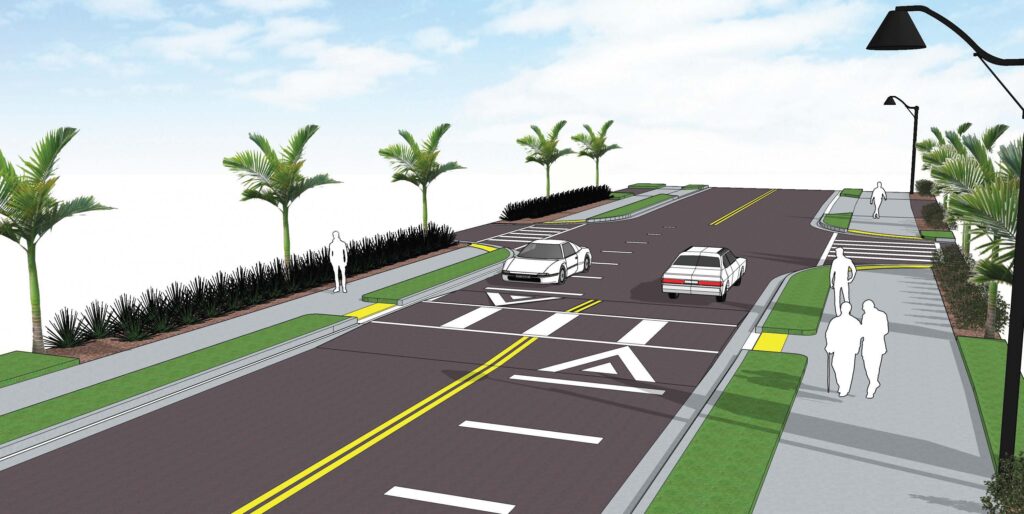
Alternative 1 - Raised Crosswalks
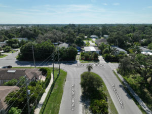
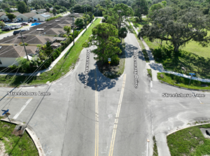
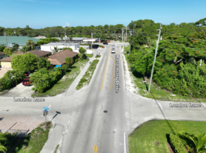
Alternative 1 includes raised crosswalks at Cape Verde Lane, Bridgeport Lane, Noble Lane, Coventry Lane, and Streetsboro Lane.
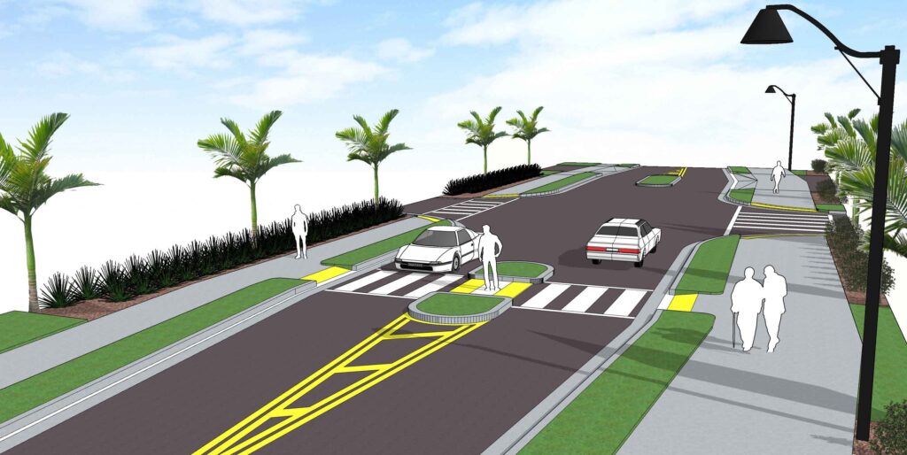
Alternative 2 - Pedestrian Refuge in the Crosswalks
Alternative 2 includes crosswalks in the same locations with a pedestrian refuge area in the crosswalk. This allows the pedestrian to cross one side of the road and wait in the middle of the road on the island until traffic is clear to cross the other lane.
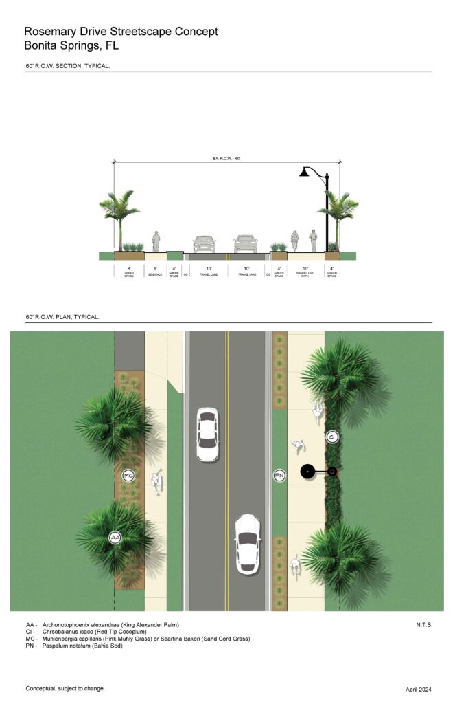
As apart of this project there are 60′ right-of-ways and 100′ right-of-ways.
60' Right-of-way from Old 41 Road to Streetsboro Lane
The concept below displays design from Old 41 Road to Streetsboro Lane that has 60′ right-of-way.
100' Right-of-way from Streetsboro Lane to Vagabond Way
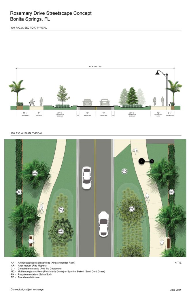
The concept below displays design from Streetsboro Lane to Vagabond way that has 100′ right-of-way.
